
Spring in Northern California is a magical time of year. The hillsides turn green and burst with color from wildflowers. Streams fill to capacity and fill up our lakes and reservoirs. One of my favorite aspects of spring though is the spectacular waterfalls that can be found throughout the region. Since Northern California is typically dry 5-6 months of the year, many of these waterfalls are seasonal and dry up by summer. To me though, this only adds to their appeal. Finding one flowing at full force when you know in a few months it will mostly (and sometimes completely) dry up makes the sight even more magnificent. This hike’s destination was to one such waterfall, named Zim Zim Falls.
Zim Zim Falls is located north of Lake Berryessa in Napa County, in the Knoxville Wildlife Area. Doing this hike is somewhat of a commitment because of the drive required to get to the trail itself. From my house in Vacaville it took us approximately an hour and 30 minutes to drive there, even though it’s only around 50 miles away. Roads around Berryessa are narrow and windy and you’ll need to take your time. Once you pass by the lake on Knoxville-Berryessa Road, the road narrows to one lane and becomes bumpier. There’s even a few concrete low water creek crossings so be careful when crossing them (one had water flowing over it as we crossed it). Parking is available just before mile marker 24. You’ll see a small pull out to your right and a green gate to your left. Start the hike through the green gate.
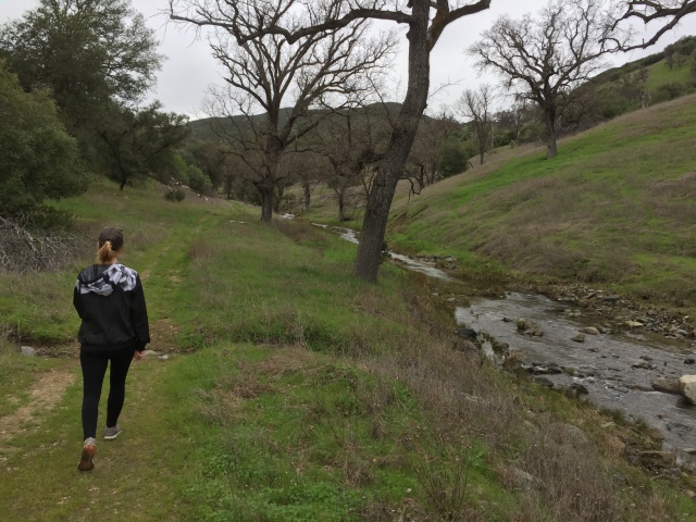
Once we started through the gate we found ourselves walking along Zim Zim Creek that led us into a small canyon. For most of the remainder of the hike the trail follows the creek up the canyon, including at least 8-9 crossings with no bridge. It’s important to note that if you do this hike, your feet will get wet. The earlier you accept this the easier it will be (take it from someone who knows). With that part out of the way, this turned out to be a great, easy hike considering the distance. Most of the canyon is flat and has no significant elevation gain until the very end approaching the falls. The trail follows Zim Zim Creek up a pretty canyon with views of the surrounding rugged terrain. It’s pretty easy to follow most of the time (it looks like at one time it was an old Jeep road).
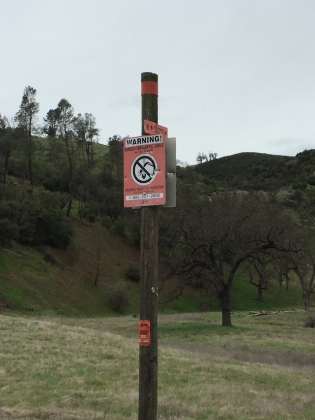
One minor curiosity was the presence of many red “DON’T DIG” signs from AT&T; a very odd sight on this trail in the middle of nowhere. I found them eventually to be useful though at times when I needed to regain the trail after a creek crossing. Overall though, we just followed the main trail all the way up the canyon until it starts to narrow. At a trail junction at the end of the canyon, there’s a large pink boulder. Here, we took the trail to the right and started heading uphill.
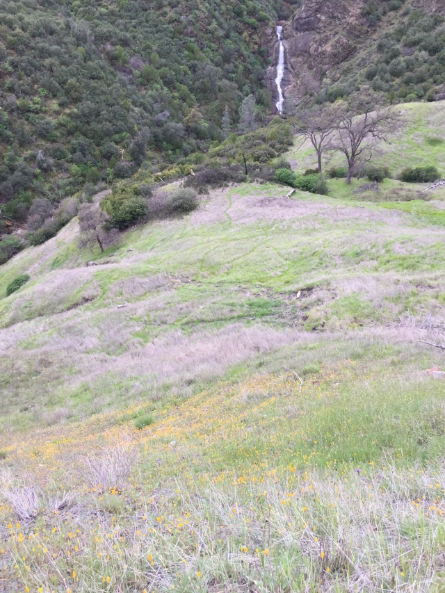
Thankfully, the uphill portion is short and soon we rounded a bend and Zim Zim Falls came into view. Though the viewing area is quite a distance away from the falls, you still get a great view of it. Here, we stopped for a quick lunch while we admired the roar of the falls.
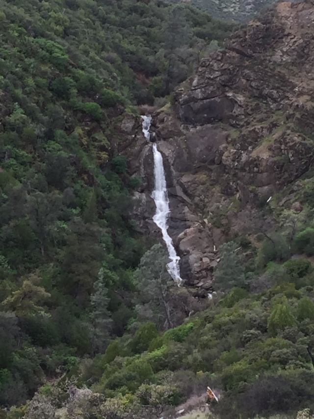
At the time of the hike (mid-March), it was going strong from all the recent rains. The trail continued farther up the side of the canyon to the top of the falls, but when we hiked part of the trail was washed out. Thus, we were content to view the falls from afar before returning back down to the canyon.
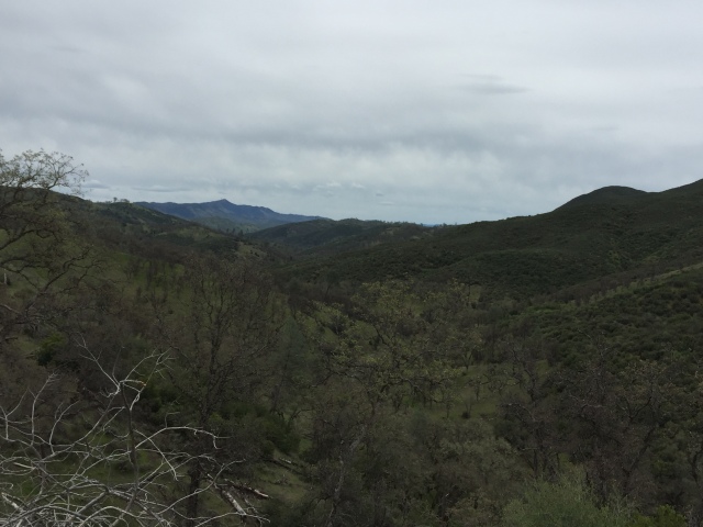
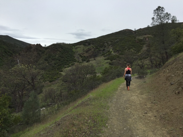
Make sure to take note of the view down the canyon as you head downhill. Straight ahead is Berryessa Peak at just over 3,000 feet. Once we returned to the pink boulder, we attempted to reach the base of the falls as other trip reports have noted. However, I found the narrow “trail” to be too treacherous for my liking and decided to turn back. We returned to the parking area just the way we came to complete an 8 mile round trip hike.
Trip Stats
Distance: 8 miles
Time: 3 hours
Elevation gain: 600 feet
Fees: Parking and access are free
Directions: From I-80 in Vacaville, take I-505 north to Winters before getting off on Highway 128 West. Follow Highway 128 up into the mountains and towards Lake Berryessa for approximately 25 miles. Make a right onto Knoxville-Berryessa Road. Drive for 23.5 miles on this road past the lake. Look for the mile markers on the right side of the road. When you see mile 23 start looking for the parking area with a green gate on the left. If you pass mile 24 you’ve gone too far. Parking is off to the right. I would recommend doing specific directions with Google Maps and print them before you go, as there is little cell reception in this remote area.
Trail map from Yolohiker can be found here.


